Corporate members

Corporate membership allows companies with interests in hydrographic and related fields to become involved with the activities of the CHA, maintaining closer contact with key users of their products and services. Through the CHA website, Corporate Members can reach a world-wide hydrographic audience

Interested in becoming a corporate member?

Join a network of leading organizations making a real impact in the hydrographic industry. As a corporate member of CHA, you’ll gain visibility, connect with top professionals, and contribute to the advancement of hydrography in Canada and beyond.

Your support helps drive innovation, education, and community initiatives, while positioning your company as a leader in responsible marine and freshwater exploration. Let’s shape the future of hydrography together.

Benefits of Corporate Membeship
  • Support your hydrographic community and our ability to host biennial Canadian Hydrographic Conferences (CHC)
  • Use of the CHA logo for business promotion purposes
  • Your logo, a link to your corporate site and a 100 word company profile on the CHA website
  • Discount on booth space purchased at Canadian Hydrographic Conferences (a $200 CAD value)
  • Participate in our CHA social media community through the sharing of announcements and job postings from your company by tagging CHA in posts on LinkedIn 
  • Opportunity to have your company profiled on CHA social media
  • Receive the latest news, events, job postings and updates
  • Access to sponsorship for local and virtual CHA events and webinars
Industry connections are essential in our mission and we`re proud to work with the following companies:
ASI Group

ASI is passionate about developing and delivering innovative solutions for our clients.

Our purpose is to use our expertise in all areas of underwater surveys and inspections, maintenance, tunneling and mussel monitoring and control to create peace-of-mind for our clients.

ASI’s success is a result of long-term and symbiotic relationships with valued clients while innovatively managing their non-core business.

HydroOctave Consulting

ASI is passionate about developing and delivering innovative solutions for our clients.

Our purpose is to use our expertise in all areas of underwater surveys and inspections, maintenance, tunneling and mussel monitoring and control to create peace-of-mind for our clients.

ASI’s success is a result of long-term and symbiotic relationships with valued clients while innovatively managing their non-core business.

M2Ocean

M2Ocean is the sole distributor of the unique HydroBall® and HydroBlock™ hydrographic survey solutions.  We are also proud distributors of the following trusted brands: Seafloor Systems – Complete Uncrewed Surface Vessel (USV) solutions, R2Sonic – Full range of multibeam sonars, AML Oceanographic – Oceanographic instrumentation (CTDs, SVPs, and more), and SBG Systems – Inertial Navigation Systems (INS) and GNSS data post-processing.
Terra Remote Sensing

Terra Remote Sensing provides international geospatial data acquisition, processing and delivery in terrestrial, marine and transitional environments
For over 100 years, The Underhill Group has established a reputation of excellence, serving clients throughout Canada, North America, and the world. We have a goal to be the most innovative Geomatics firm in Canada – our membership with the Canadian Hydrographic Association, and our practice in the field of hydrography contributes to our goal.
A company that specializes in hydrographic training and courses for the hydrographic survey, dredging and offshore construction industry since 2000. Courses and training developed by people who gained their experience in the field and taught by those same individuals. The heart of the company is that the skills its people possess can be traded or exchanged with others, thus improving their hydrographic knowledge and understanding.
Interdisciplinary Centre for the Development of Ocean Mapping

Research and development in marine geomatics, hydrography and hydrospatial.

The Interdisciplinary Centre for the Development of Ocean Mapping (CIDCO) is a marine geomatics and hydrospatial R&D organization. Dedicated to the enhancement of state-of-the-art technology for hydrospatial data acquisition, management and graphic representation, CIDCO is a not for profit organization answering the R&D needs of the industry and the community at large.

Global Provider of Geospatial solutions and services

IIC Technologies is a ISO 27001:2022, ISO 20000-1:2018 and ISO 9001:2015 accredited provider of geospatial solutions and services for the acquisition, management, integration and dissemination of geospatial data. With global presence, IIC Technologies provides end-to-end geospatial solutions to the Aeronautics, Defense, Government, Infrastructure, Marine, Oil & Gas, Transportation and Utility sectors.

NORBIT is a global provider of tailored technology to selected niches, solving challenges through sustainable and innovative solutions, in line with its mission to ‘Explore More’. NORBIT Subsea develops and manufactures wideband sonar systems for applications in the hydrographic, security, energy, and dredging markets. This includes specializing in ultra-compact and high performance multibeam sonars for subsea and surface platforms.
Compared to satellite weather, crowdsourcing from other vessels uses actual measurements that are more accurate, higher resolution and in real time. Even the best voyage optimization software is only as good as the data it uses.

With actual measurements from other vessels up ahead, a ship can more accurately calculate its arrival time in port, allowing it to reduce boat speed as much as possible. This is the best way to reduce fuel consumption and greenhouse gas emissions. Data that captains can trust when planning a route. No need to risk heading off course. Just save on fuel and meet CII emissions regulations.

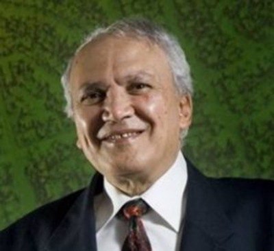
Sam Masry

Salem (Sam) Masry (1938-2020) immigrated to Canada from Egypt in 1966 after completion of his PhD at University College, London. He began his career at the University of New Brunswick where he became a professor and a founding member of the department of Surveying Engineering. Dr. Masry was a pioneer in the field of digital mapping and, in 1979, founded CARIS to develop digital mapping software, growing to be one of the leading companies in its field internationally. Sam received many awards in recognition of his work and his contributions to his community, including the Talbert Adams Grand Award by the American Society of Photogrammetry, appointments to the Order of Canada and the Order of New Brunswick, and an honorary Doctor of Science from UNB. Sam was an ethical and dedicated leader and entrepreneur with international influence, and a major champion for the importance of well-managed hydrographic and other digital data for the benefit of all.

Larry Mayer

Larry Mayer is a Professor and the Director of the Center for Coastal and Ocean Mapping at the University of New Hampshire. He graduated magna cum laude with an Honors degree in Geology from the University of Rhode Island in 1973 and received a Ph.D. from the Scripps Institution of Oceanography in Marine Geophysics in 1979. At Scripps, he worked with the Marine Physical Laboratory’s Deep-Tow Geophysical package, applying this sophisticated acoustic sensor to problems of deep-sea mapping and the history of climate. After being selected as an astronaut candidate finalist for NASA’s first class of mission specialists, Larry went on to a Post-Doc at the School of Oceanography at the University of Rhode Island where he worked on the early development of the Chirp Sonar and problems of deep-sea sediment transport and paleoceanography. In 1982, he became an Assistant Professor in the Dept. of Oceanography at Dalhousie University and in 1991 moved to the University of New Brunswick to take up the NSERC Industrial Research Chair in Ocean Mapping. In 2000 Larry became the founding director of the Center for Coastal and Ocean Mapping at the University of New Hampshire and the co-director of the NOAA/UNH Joint Hydrographic Center.

Larry has participated in more than 95 cruises (over 75 months at sea!) and has been chief or co-chief scientist of numerous expeditions, including two legs of the Ocean Drilling Program and nine mapping expeditions in the ice-covered regions of the high Arctic. He has served on, or chaired, far too many international panels and committees and has the requisite large number of publications on a variety of topics in marine geology and geophysics. He is the recipient of the Keen Medal for Marine Geology and an Honorary Doctorate from the University of Stockholm. He was a member of the President’s Panel on Ocean Exploration, National Science Foundation’s Advisory Committee for the Geosciences, and chaired a National Academy of Science Committee on national needs for coastal mapping and charting as well as the National Academies report on the impact of the Deepwater Horizon Spill on ecosystem services in the Gulf of Mexico. He was the co-chair of the NOAA’s Ocean Exploration Advisory Working Group, and the Vice-Chair of the Consortium of Ocean Leadership’s Board of Trustees.  He is currently the Chair of the National Academies of Science’s Oceans Studies Board, Chair of the MARUM Science Advisory Board, and is a member of the State Dept.’s Extended Continental Shelf Task Force and the Navy’s SCICEX Advisory Committee. In 2016, Larry was appointed by President Obama to the Arctic Research Commission and in 2017 he was elected to the Hydrographic Society of America Hall of Fame. In 2018, he was elected as a member of the National Academy of Engineering, and, in 2019, was elected as a foreign member in the Royal Swedish Academy of Sciences.  In 2020, Larry was selected as the first recipient of the Walter Munk Medal from the The Oceanography Society and named a Fellow of the American Geophysical Union. In 2021 Larry was elected to Norwegian Academy for Polar Research.

Larry’s current research deals with increasing the efficiency and effectiveness of seafloor mapping and remote characterization of the seafloor (including the use of autonomous vehicles) as well as advanced applications of 3-D visualization to ocean mapping problems and applications of mapping to Law of the Sea issues, particularly in the Arctic.

Denis Hains

Denis Hains is a leader in the global hydrographic community and is recognized for his substantial contributions, commitment and influencer role as the global instigator of the Hydrospatial Movement Club & Community (https://www.linkedin.com/groups/12556091/) and his leadership in advancing ocean mapping networking, technologies and standards.

A bit more than a year after retiring as the Director General of the Canadian Hydrographic Service with Fisheries and Oceans Canada and as Hydrographer General of Canada; he founded H2i (Hains Hydrospatial International Inc.). He is also notable for being the US-Canada representative on the International Hydrographic Review (IHR) Editorial Board of the International Hydrographic Organization (IHO).

Denis also holds the honor of being one of the five international members of The Nippon Foundation, General Bathymetric Chart of the Oceans (GEBCO)-Seabed 2030 Strategic Advisory Group. He also shares his expertise and leadership as an affiliate research scientist at the University of New Hampshire’s Center for Coastal and Ocean Mapping in the USA.