Canadian GoGeomatics Expo & Career Fair
![]()
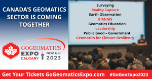
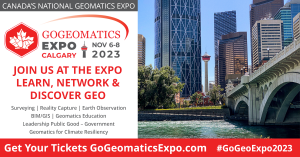
The GoGeomatics Expo and Career Fair in Calgary from Nov 6-8th is bringing the Canadian and international geospatial communities together for a national event.
The Expo is the first of an annual series of geomatics technology events. Components include workshops, demonstrations, training, speaking and award programs. A Career Fair will be held adjacent to the Expo, with free public access.
The Expo has two exceptional educational partners, SAIT (Southern Alberta Institute of Technology)
and the Schulich School of Engineering at the University of Calgary. The committee and partners are
working together to highlight the excellence of the Canadian geomatics sector on a global scale.
This community-driven event will be a diverse gathering and celebration of our sector’s
professionals, thought-leaders, innovators, entrepreneurs, companies, government, recent graduates
and students.
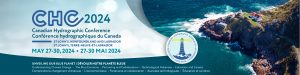
CANADIAN HYDROGRAPHIC CONFERENCE 2024
SAVE THE DATE
CHC2024
St. John’s, Newfoundland and Labrador
May 27-30, 2024
IIC Academy Launches Its Hydrographic
Surveying Program to the General Public
Click here for IIC Academy Hydrographic Surveying Program
New edition of the standard S-44 of IHO in french version
The standard S-44 of IHO (International Hydrographic Organization), related to hydrographic surveys, was updated in its sixth edition on September 2020, first as an english version.
Today, the french version is on line, result of a collaboration between SHOM https://www.shom.fr/, l’association française d’hydrographie (AFHY https://www.afhy.fr/) and the Canadian Hydrographic Association (CHA https://hydrography.ca).
The english version is available on the IHO website (https://iho.int/en) or directly at this address : https://iho.int/uploads/user/pubs/standards/s-44/S-44_Edition_6.0.0_EN.pdf
Sean Hinds
10 May 1955 – 04 Feb 2021
Sean was born May 10, 1955, in Barrie, Ontario. He spent his childhood in Barrie, London, and then Thornhill. He started his own family in Georgetown, then moved to Manotick, and later retired in Nepean. Sean had an extraordinary career. He received his Honours Diploma in Hydrographic Survey Technology from Humber College in 1981. He was commissioned as a Canada Land Surveyor and was a Field Hydrographic Surveyor. He helped create the nautical charts and the digital infrastructure to allow for the safe and efficient navigation at sea and in the Great Lakes. Early in his career Sean was posted to expeditions to chart the Arctic Ocean where his team lived in tents in extreme weather conditions. In the Arctic, Sean even survived a helicopter crash and lived to tell the story of the rescue amidst a fierce storm. Eventually Sean became a Senior Advisor in the Department of Fisheries and Oceans Canada (DFO) travelling to many countries to share his knowledge and work. In 2012, Sean was honoured for his hard work and service to the Government of Canada with a special Governor General’s Award, the Queen Elizabeth’s II Diamond Jubilee Medal. This recognition was a source of pride for both his family and his father who travelled to Ottawa for the ceremony. At the end of 2015, Sean retired from DFO after 35 years of dedicated service.
Our sincere condolences to the family!
Sincerely,
Richard Sanfaçon
CHA President
Prix Geomatica Award 2020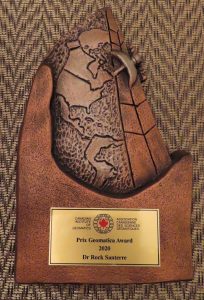
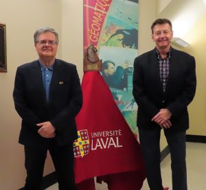
Dr Rock Santerre receiving the 2020 Geomatica Award from Richard Sanfaçon, President of the Canadian Hydrographic Association who represents here the Canadian Institute of Geomatics
Dr. Rock Santerre’s Vitae Summary (November 2020)
Rock Santerre has been a professor in the Department of Geomatics Sciences at Laval University from 1990 to 2017 and the Director of the Geomatics Engineering program from 2007 to 2011. He was a founding member of the Centre for Research in Geomatics (CRG) and he is now a CRG honorary member.
He taught several coursesto more than 1200 students in addition to 700 professionals who attended his continuing education GPS courses. Hehas supervised orco-supervisednearly 40graduate students coming from 10 countries.
His research activities were mainly related to high precision GPS (GNSS) positioning and navigation. Dr. Santerre is the author and co-author of about 240 publications and presentations. His papers have been cited in publications written in 17 languages. He was a member of several IAG (International Association of Geodesy) Special Study Groups for almost 20 years. Dr. Santerre also acted as one the Associate Editors for the CIG journal Geomatica from 1997 to 2009. He also holds three GPS patents.
Dr. Santerre continue to contribute to the popularization of Geomatics by the realization of exhibitions and the publication of papers on the history of Geomatics.
